On a map, the fastest route between two checkpoints might look obvious: draw a straight line and follow it. In expedition adventure racing, that approach can turn a good race into several exhausting hours inside a swamp, steep forest, or rocky mountainside.
Route selection is one of the skills that separates experienced adventure-racing teams from competitors who are simply fast runners, cyclists, or paddlers.
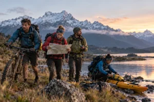
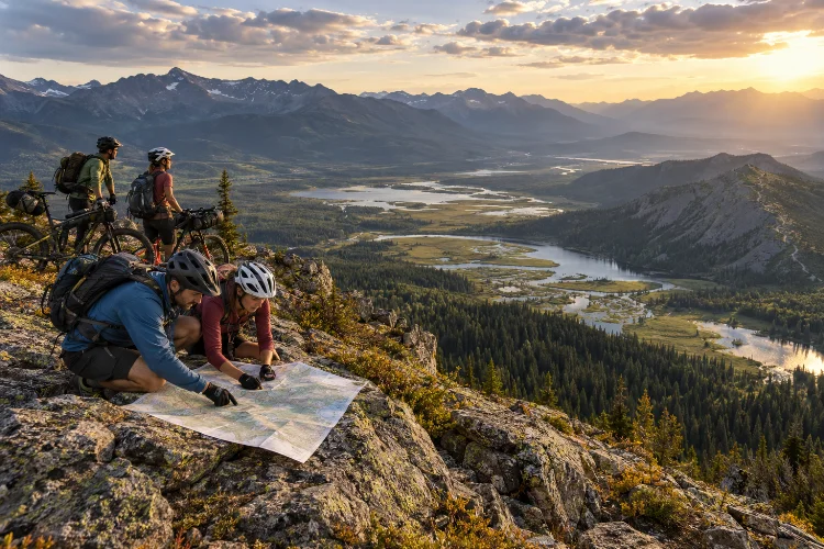
Expedition races can continue for several days and cover hundreds of kilometres. Teams navigate between checkpoints using maps and compasses while switching between trekking, mountain biking, paddling, and sometimes technical disciplines.
Adventure Racing World Series events can last three to ten days, making every navigation decision potentially significant.
That is why strategic route selection in expedition adventure racing is really an exercise in time management. The shortest line on the map is not necessarily the quickest, safest, or smartest.
Successful teams constantly balance distance, terrain, elevation, fatigue, uncertainty, and risk before deciding where to go.
The Shortest Route Is Rarely Automatically the Fastest
One of the first lessons adventure racers learn is that distance alone is a poor way to judge a route.
Imagine checkpoint B sits only four kilometres from checkpoint A. A direct line crosses dense vegetation, climbs 500 metres, and finishes through a wet valley. Another option follows a gravel road for seven kilometres with relatively little climbing.
The longer option could easily be faster.
USARA specifically advises racers to consider elevation, swamps, vegetation, cliffs, trails, roads, and open terrain rather than automatically choosing the straightest route. Established tracks can make a longer route significantly quicker.
Experienced teams therefore think about travel time per kilometre.
A kilometre on smooth gravel while cycling may disappear quickly. One kilometre of off-trail travel through thick vegetation could take several times longer.
This is where route selection becomes strategic rather than geometric.
The best choice is usually the route with the lowest realistic time cost – not necessarily the smallest distance printed on the map.
Elevation Can Be More Expensive Than Extra Distance
Contour lines deserve enormous attention during route planning.
Two routes may appear almost identical in length, yet one could require repeated climbing and descending while another follows a valley or ridgeline.
Every climb consumes energy.
In a short race, athletes may accept a steep ascent because it saves distance. During a multiday expedition, however, unnecessary climbing can create fatigue that affects later stages.
Teams therefore examine total elevation, steepness, trail quality, and whether climbing produces any meaningful advantage.
A long gradual ascent on a good road may be preferable to a shorter, brutal climb through rough terain.
Descending also deserves attention.
A steep downhill line might look fast on the map, but loose rock, vegetation, cliffs, or poor visibility can slow movement dramatically. Mountain bikers may even be forced to carry their bikes down terrain that appeared attractive during map planning.
Strong navigators learn to mentally convert contours into effort before committing to a route.
Terrain Speed Changes the Value of Every Route
Maps contain clues about how quickly a team might move through different landscapes.
Open fields, maintained trails, gravel roads, forests, marshes, rocky ground, river valleys, and mountain ridges all produce different travel speeds.
USARA notes that adventure racers must become comfortable reading many types of maps because long races may rely on standard topographic maps rather than highly detailed orienteering maps. Symbols and mapping conventions can also differ between events.
That makes interpretation essential.
A dotted line might represent an excellent rideable track – or something barely visible on the ground.
Vegetation shown on an older map may have changed completely.
Good teams therefore avoid assuming that every mapped feature will behave exactly as expected.
They build alternatives into their plan.
For example, a navigator might decide to follow a forest road but identify a nearby ridge as a backup if the road disappears. This flexibility prevents one incorrect assumption from becoming a major navigaton disaster.
Navigation Risk Should Be Treated Like Time
Some routes are physically fast but navigationally dangerous.
Suppose one option follows a river for eight kilometres before turning onto an obvious trail. Another saves two kilometres by crossing complex forest with several similar ridges and small valleys.
The direct route may be quicker if executed perfectly.
But expedition racing rarely happens under perfect conditions.
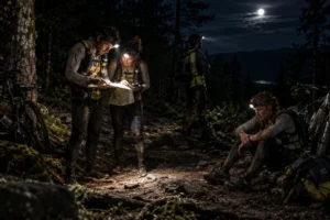
Athletes may be wet, hungry, cold, and sleep deprived. Darkness can remove distant landmarks, while fog can make large terrain features difficult to recognize.
Navigation errors can easily erase the theoretical advantage of a shortcut.
Research involving experienced orienteers has found that mental fatigue can negatively affect conscious decision-making, while older experimental research also found that physical fatigue impaired the ability to process visual navigation information.
That matters enormously during a race lasting several days.
A smart navigator may therefore choose a slightly slower but easier-to-follow route at 3 a.m. even if a complex shortcut looked attractive twelve hours earlier.
Route selection is partly about asking: How likely are we to execute this correctly in our current condition?
Checkpoint Approach Can Matter More Than the Main Route
Reaching the general area of a checkpoint is only part of navigation.
The final approach can consume surprising amounts of time.
A checkpoint hidden in a small valley, stream junction, hillside feature, or forest depression may be difficult to locate from every direction.
Experienced racers therefore choose a route that gives them a reliable final reference.
For example, they may approach from a major trail junction, distinct hilltop, river bend, or obvious ridgeline before making the final move toward the checkpoint.
This reduces uncertainty.
International Orienteering Federation guidance emphasizes that successful navigation combines detailed map interpretation, concentration, and rapid route-choice decisions rather than simply following a predetermined path.
In expedition racing, this idea becomes even more valuable because a ten-minute checkpoint search repeated several times can create a large time deficit.
A technically longer approach that makes the control easy to find may therefore be more efficent than attacking it directly from complicated terrain.
Race Rules Can Eliminate Otherwise Perfect Routes
Strategic freedom does not mean teams can travel anywhere they want.
Race organizers may designate private property, dangerous roads, environmentally sensitive zones, or other locations as out of bounds. They can also require competitors to follow mandatory routes through specific areas.
Adventure Racing World Series rules state that teams must avoid designated prohibited areas and follow mandatory routes when organizers specify them. Private property is generally out of bounds unless explicitly permitted by the race organization.
This creates another planning layer.
A road visible on the map might offer the fastest theoretical route but be illegal to use.
Teams therefore need to read race instructions just as carefully as maps.
Misunderstanding one restriction can result in penalties or force racers to retrace their route.
The fastest route in expedition racing is always the fastest legal route.
That sounds obvious, but exhausted competitors sometimes make very expensive mistakes.
Fatigue Changes What Counts as a Good Route
A route chosen during the opening hours may not be appropriate two days later.
Early in a race, athletes might comfortably climb steep terrain, move quickly off trail, and make complicated navigational decisions.
After 50 hours, everything changes.
Feet may be sore, cycling power may have dropped, concentration can become unreliable, and one teammate may be struggling more than the others.
Expedition events also introduce unique strategic challenges including sleep management, body care, gear management, and long stages that can exceed the duration of entire shorter races.
That means route choices should reflect the team’s current condition, not its theoretical ability.
A strong team might initially plan an aggressive mountain shortcut. If one athlete develops foot problems, a longer road option could suddenly become the faster overall decision.
Rigid teams often lose time trying to force a plan that no longer makes sense.
Good teams continually reassess.
Weather Can Rewrite the Map
A route that looks perfect before heavy rain may become terrible afterward.
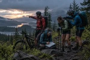
A shallow stream can turn into a dangerous crossing. Dirt roads can become muddy. Exposed ridges may become uncomfortable or risky in strong wind, while fog can make precise navigation much harder.
Adventure Racing World Series materials highlight unpredictable weather and challenging terrain as fundamental parts of expedition competition.
Teams therefore need to interpret weather tactically.
After sustained rain, staying on higher ground may become more attractive than crossing valleys filled with saturated soil. During extreme heat, a slightly longer route near reliable water might be worth the extra distance.
Weather also affects different disciplines differently.
Headwinds can dramatically increase paddling time. Wet rocks can slow trekking, while muddy trails can turn a fast bike section into hours of pushing.
Route planning is consequently never completely finished until the team has actually travelled through the terrain.
Team Strengths Should Influence Route Selection
There is no universally perfect route because different teams move differently.
One team may contain exceptional mountain bikers who can gain time on technical trails. Another may be stronger during steep trekking sections. Some teams have extremely confident navigators who are comfortable taking complex off-trail lines at night.
Strategic route selection should exploit those strengths.
If two routes appear similar in predicted time, choosing the one that suits the team’s strongest discipline may reduce risk.
The opposite also applies.
A technically difficult descent might be efficient for elite riders but slow and dangerous for a team with weaker mountain-bike skills.
Adventure racing is fundamentally a team sport, and ARWS competition requires teammates to remain together around checkpoints rather than allowing one athlete to race ahead independently.
The relevant question is therefore not, “What is the fastest route?”
It is, “What is the fastest route for this team right now?”
That small difference changes almost every decison.
Good Route Selection Is About Managing Risk
Elite route planning rarely involves choosing between one obviously correct path and one obviously bad path.
Usually, competitors compare several imperfect choices.
One route might be shorter but harder to navigate. Another may include more climbing but better trails. A third could be long yet extremely reliable.
The goal is to understand the trade-offs.
This is one reason navigation practice matters so much. USARA encourages racers to repeat routes using different options so they can learn how distance, elevation, vegetation, and trails affect actual travel time.
Over time, experienced racers build an internal library of terrain speeds.
They become better at predicting how long a climb, bushwhack, trail ride, or river crossing will actually take.
That knowledge makes route choice less like guessing and more like calculation.
Not every decision will be correct, but strong teams reduce the number of expensive mistakes.
Strategic route selection in expedition adventure racing is about much more than finding the shortest line between checkpoints.
Teams must compare distance with elevation, terrain speed, navigational difficulty, weather, race restrictions, fatigue, and their own strengths.
A longer road can beat a direct forest crossing, while an easy-to-navigate route may save hours when athletes are exhausted or racing through darkness.
The best adventure racers also remain flexible. They know that conditions can change and that yesterday’s perfect route may become today’s bad choice.
Ultimately, expedition racing rewards teams that can move efficiently while continuing to make sensible decisions under pressure.
If you want to improve your own route strategy, practise navigating the same checkpoints using several different paths. Comparing your predicted times with the actual results is one of the fastest ways to understand what truly makes a route efficient.